Santa Fe Airport Part 77 Arrival and Departure Zone Analysis
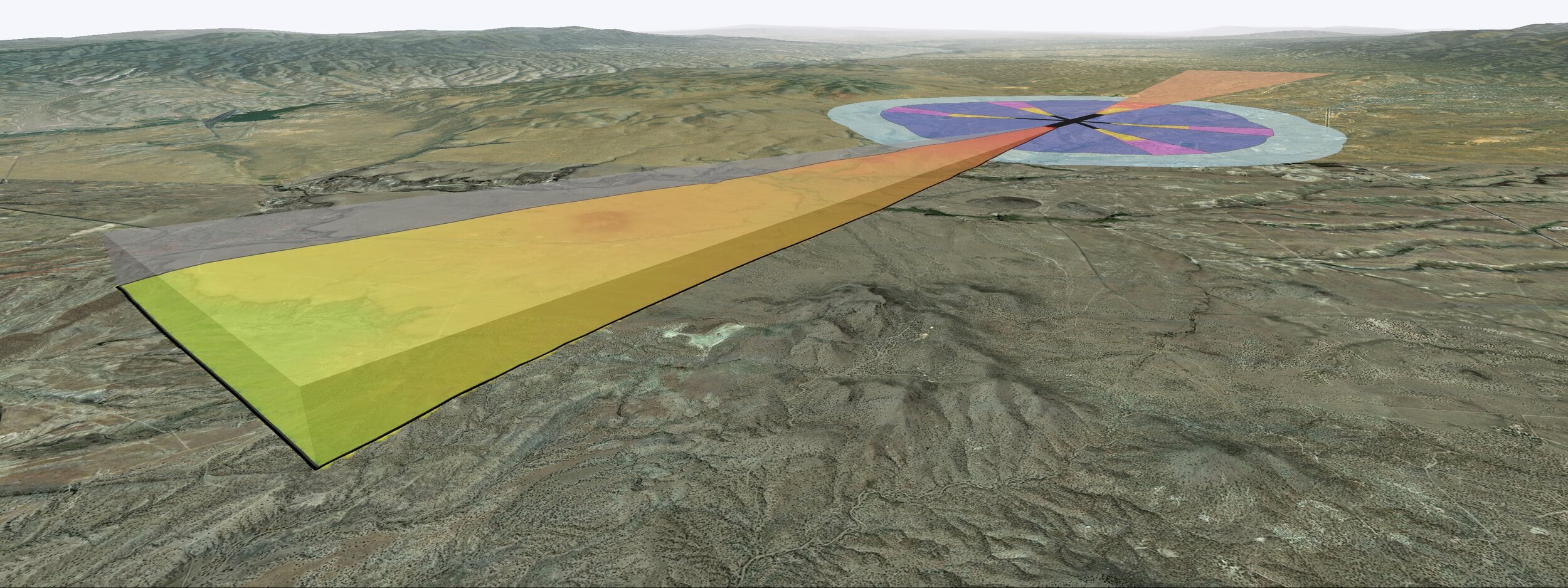
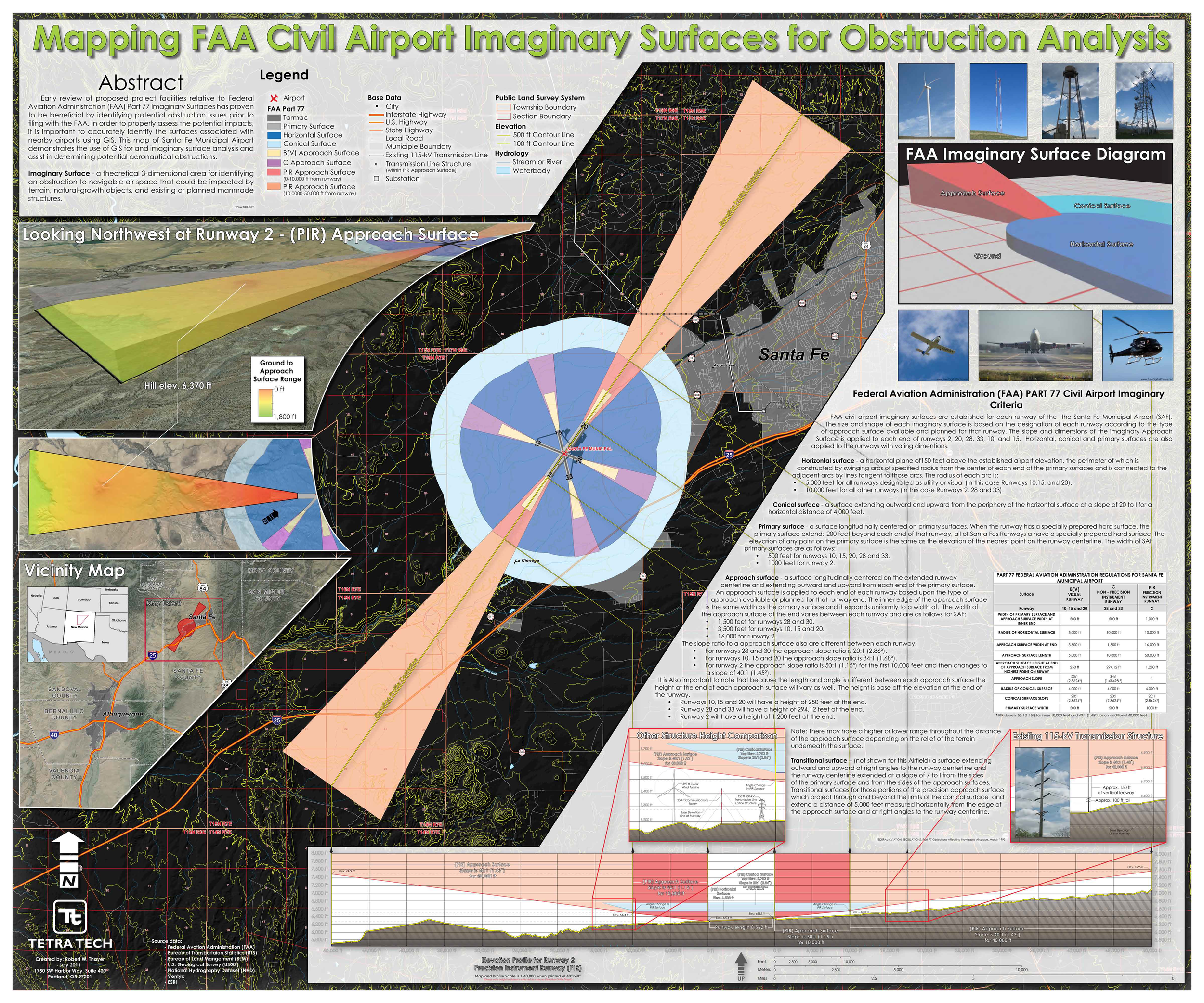
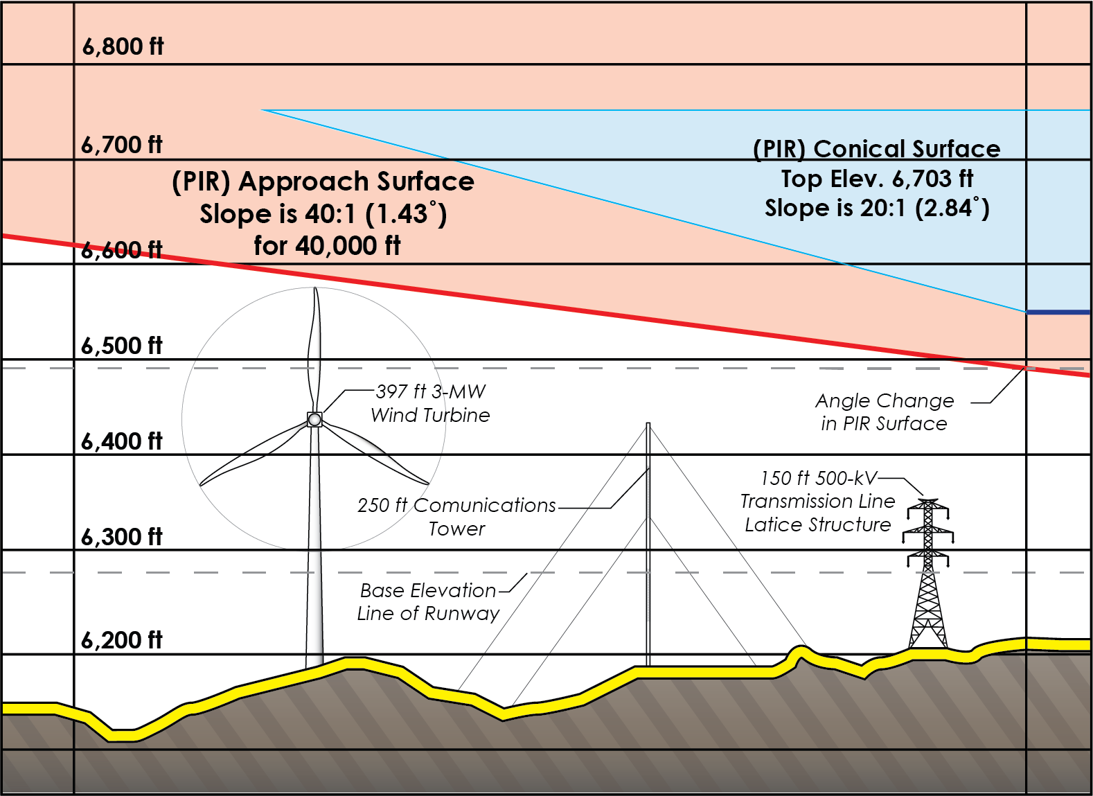
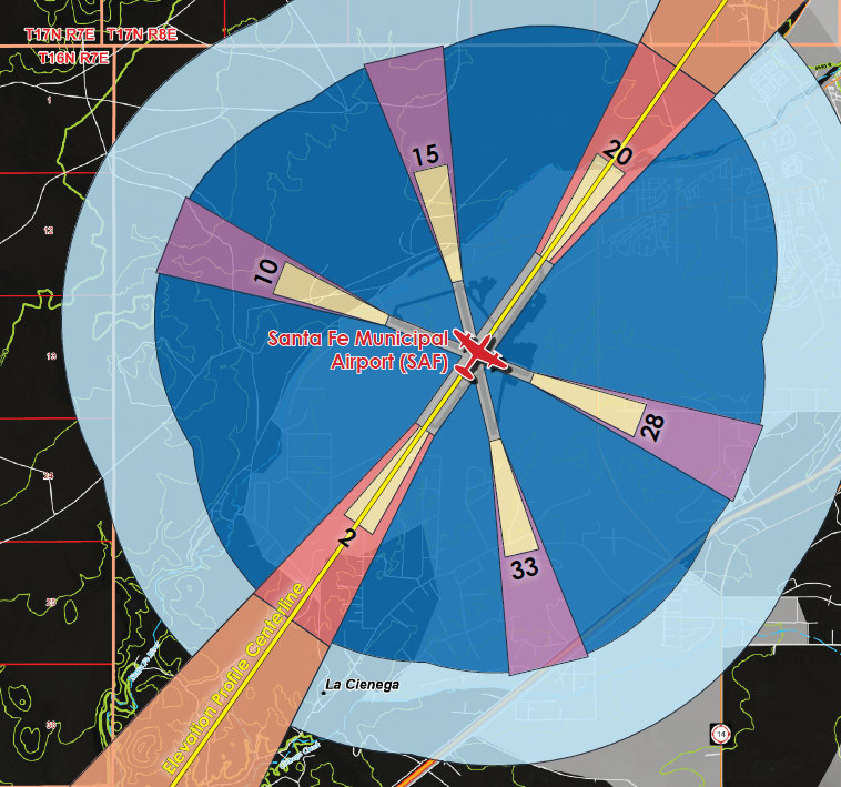
This map of Santa Fe Municipal Airport demonstrates the use of GIS for a Federal Aviation Administration (FAA) Part 77 obstruction analysis. A Pre-permit evaluation for potential 115-kV transmission line within navigable airspace. The FAA requires a Part 77 Imaginary Surface evaluation prior to filing for construction permits with the proximity of public airports. In order to properly assess the potential impact, it is important to define the surface in both the 2-dimensional and 3-dimensional realms. Using GIS coordinate geometry to define the surfaces on the 2-dimensional plan first, then assessing the appropriate elevation ranges within each Imaginary Surface. Imaginary Surface is a theoretical 3-dimensional area for identifying obstructions to navigable airspace for both built and natural obstacles.